


Description
Harnessing AI and Machine Learning for Geospatial Analysis Course will teach you to use AI techniques for geospatial data and solve real-world problems. The instructor starts with Python and R programming languages because these are the basics you need to master first. Then, he will talk about machine learning and deep learning, as well as topics like classification and environmental data analysis.
This course has many projects, so you will learn to use these techniques in real-world problems. If you finish this class, you will be able to solve any geospatial challenges while improving the accuracy of the provided data. Join us!
Demo
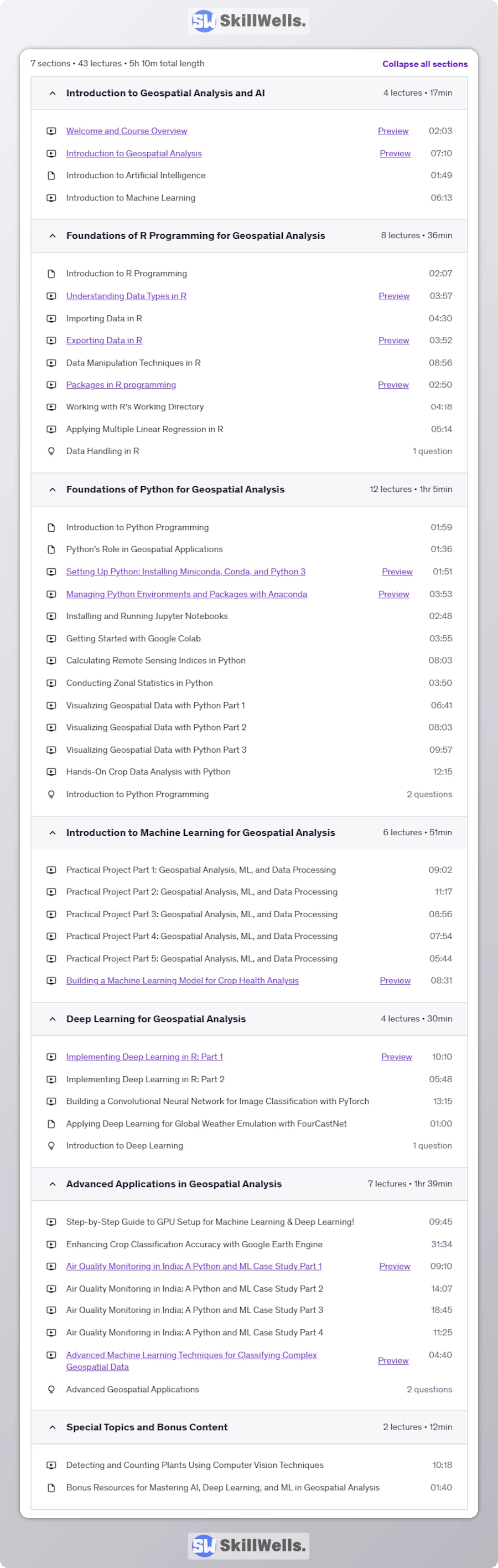
Table of Content


Reviews
Clear filtersThere are no reviews yet.